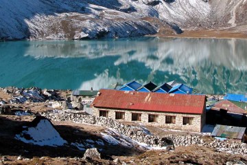
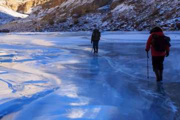
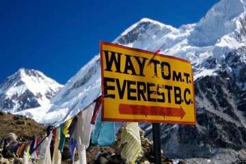

Trekking
Adventure
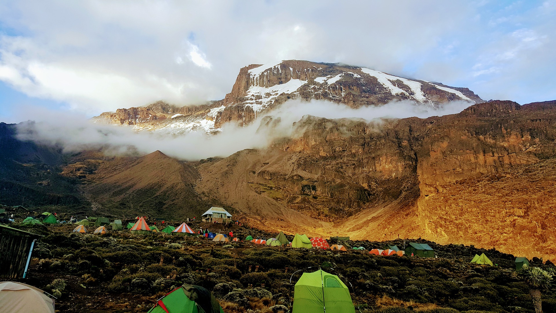
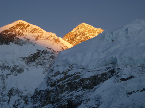
Mount Kilimanjaro lies on the border of Tanzania and Kenya, just south of the Equator. To the west lies the Great African Rift Valley, created by tremendous tectonic forces which also gave birth to a string of other volcanoes. One of these, Mount Kenya, was originally much higher than Kilimanjaro. The three summits of Mount Kilimanjaro, Shira, Kibo and Mawenzi are all of very recent origin.
Although East Africa and nearby Olduvai Gorge is thought to be the cradle of mankind it is unlikely that early man would have been attracted to the steep and cold slopes of Kilimanjaro at a time when it was probably very active and dangerous.
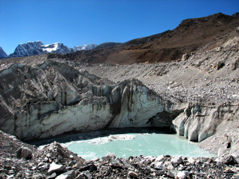
Lying just south of the equator, Kilimanjaro is affected by the passage of the Inter-tropical Convergence Zone, which brings with it the main rainy periods. The highest rainfall occurs between mid-March and early May, and slightly less between the beginning of November and late December. Maximum rainfall occurs in the forest belt and on the south side of the mountain where it reaches 2000mm. per year.
Precipitation on the summit is about 100mm. per year; this coupled with the very porous ash soils results in the Saddle being considered a high altitude desert. Rain and, higher up, snow, can however be encountered at any time of year – even in the driest periods (January, February and September).
Normally the drier seasons are associated with clear, dry weather which can last for weeks on end. The best weather is generally encountered in the mornings, and convectional rainfall, if any, tends to come in mid-afternoon. After long periods of dry weather some of the higher streams dry up.
Temperatures vary considerably with height and time of day. On the plains surrounding Kilimanjaro the average temperature is about 30°C. At 3000 m frosts can be encountered at night while day time temperatures range from 5 to 15°C. Night time temperatures on the summit can be well below freezing.
When to go . . .
Anytime! All seasons have their attractions – a good day in the rainy periods can sometimes provide superb views as the air is then very clear, however deep snow and heavy rain could stop or marr your trip. The safest months are: mid-December to mid-March then June to October.
The Lemosho Route …
There are several routes to attempt Kilimanjaro from. The Lemosho Route is considered the most scenic trail on Kilimanjaro, granting panoramic vistas on various sides of the mountain. As one of the newer routes, Lemosho is a superb choice for your climb. It is our preferred route due to its ideal balance of low crowds, beautiful scenery and the highest summit success rate. The route approaches Mount Kilimanjaro from the west, beginning with a long drive from Moshi to Londorossi Gate. From there, the first two days are spent trekking through the rain forest to Shira Ridge. The Lemosho route crosses the entire Shira Plateau from west to east in a pleasant, relatively flat hike. Crowds are low until the route joins the Machame route near Lava Tower. Then the route traverses underneath Kilimanjaro’s Southern Ice Field on a path known as the Southern Circuit before summiting from Barafu. Descent is made via the Mweka route.
TOUR HIGHLIGHTS
| Total Duration | 9 Nights / 10 Days (On trek 8 days/ 7 nights) |
|---|---|
| Style of Trip | Trekking |
| Grade | Challenging |
| Maximum Altitude | 5,895 m / 19,500 ft |
| Best Season | Feb 8-17 and July 11-20 |
| Accommodation | Hotel – 02; Organized Camping – 07 |
| Food | On trek – All meals included; Hotel – Breakfast and dinner |
| Travel | In small non-AC vehicles |
Cost
- USD 2650/- per person
- 5% GST extra.
- Based on a minimum group size of 4
Included
On the Kilimanjaro Climb:
- 2 nights hotel on a half board basis
- All transfers, guides, cook, porters, an armed Ranger on Mt Meru
- Tents, mattresses, fully equipped mess tent (except on the Marangu Route and Mt Meru), portable WC (not on the Marangu Route or Mt Meru)
- Park fees, camping fees (or hut fees on the Marangu Route & Mt Meru)
- Three hot and copious meals a day on the mountain
- Rescue fees
- Oxygen and decompression bag
- All our guides are licensed and qualified and speak English and trained in the use of the decompression bag and First Aid.
Not Included
- International flights
- Visas
- Health & travel insurance
- Any extra expenses incurred in the hotel such as room service, bar, laundry etc.
- Tips for our personnel at your discretion (We operate an envelope system so that clients are not importuned)
EXTRA CHARGES:
- Gluten-free food on the mountain = 30 USD per trip (there is no extra charge for other special diets such as vegetarian or vegan).
- Shower on request for a small group supplement of 800USD per trip
- Extra Transfers of 50 USD per one way trip if the group members arrive at different times.
- Clothing and equipment such as sleeping bags, poles, waterproof gear and high altitude wear, waterproof hold-alls and rucksacks can be hired on request
1
Day 01: KARIBU (WELCOME): ARRIVE AT KILIMANJARO INTERNATIONAL AIRPORT, TANZANIA AND DRIVE TO MOSHI (45 mins)
You will be met by some of your team at the airport and transferred to your hotel for dinner. After that, your guide will brief you and you will have time to prepare your bags for tomorrow’s climb. Put all that you need for the summit, and the higher altitudes in a waterproof bag (max 16 kgs), which will be carried by the porters throughout the climb. Your personal belongings, camera, passport, anything you need while hiking will go into your small waterproof day pack. Anything you need for the rest of your holiday can be left with us and locked in our office lock up.
2
Day 02: LONDOROSSI GATE TO MTI MKUBWA
| Elevation:7,742 ft to 9,498 ft | Distance: 6 km | 4 miles |
|---|---|
| Hiking Time: 3-4 hours | Habitat: Rain Forest |
We depart Moshi for Londorossi Gate, which takes about 4 hours, where you will complete entry formalities. Then drive to the Lemosho trailhead. Upon arrival at trailhead, we begin hiking through undisturbed forest which winds to the first camp site.
3
Day 03: MTIMKUBWA CAMP TO SHIRA 1 CAMP
| Elevation: 9,498 ft to 11,500 ft | Distance: 8 km | 5 miles |
|---|---|
| Hiking Time: 6 hours | Habitat: Heath |
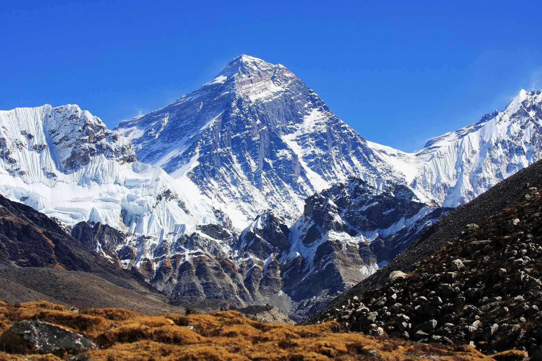
We continue on the trail leading out of the rain forest and into a savannah of tall grasses, heather and volcanic rock draped with lichen beards. As we ascend through the lush rolling hills and cross several streams, we reach the Shira Ridge before dropping gently down to Shira 1 Camp. Here we catch our first glimpse of Kibo across the plateau.
4
Day 04: SHIRA 1 CAMP TO MOIR HUT
| Elevation: 11,500 ft to 13,800 ft | Distance: 11 km | 7 miles |
|---|---|
| Hiking Time: 5-7 hours | Habitat: Heath |
We explore the Shira Plateau for a full day. It is a gentle walk east on moorland meadows towards Shira 2 Camp. Then we divert from the main trail to Moir Hut, a little used site on the base of Lent Hills. A variety of walks are available on Lent Hills making this an excellent acclimatization opportunity. Shira Plateau is one of the highest plateaus on earth.
5
Day 05: MOIR HUT TO LAVA TOWER
| Elevation: 13,800 ft to 15,190 ft | Distance: 7 km | 4 miles |
|---|---|
| Hiking Time: 4-5 hours | Habitat: Alpine Desert |
LAVA TOWER TO BARRANCO CAMP
| Elevation: 15,190 ft to 13,044 ft | Distance: 3 km | 2 miles |
|---|---|
| Hiking Time: 2-3 hours | Habitat: Alpine Desert |
We begin the day climbing up a ridge and then head southeast towards the Lava Tower – a 300 ft tall volcanic rock formation. We descend down to Barranco Camp through the strange but beautiful Senecio Forest to an altitude of 13,000 ft. Although you begin and end the day at the same elevation, the time spent at higher altitude is very beneficial for acclimatization.
6
Day 06: BARRANCO CAMP TO KARANGA CAMP
| Elevation: 13,044 ft to 13,106 ft | Distance: 5 km / 3 miles |
|---|---|
| Hiking Time: 4-5 hours | Habitat: Alpine Desert |
We begin the day by descending into a ravine to the base of the Great Barranco Wall. Then we climb the non-technical but steep, nearly 900 ft cliff. From the top of the Barranco Wall we cross a series of hills and valleys until we descend sharply into Karanga Valley. One steep climb up, leads us to Karanga Camp. This is a shorter day meant for acclimatization
7
Day 07: KARANGA CAMP TO BARAFU CAMP
| Elevation: 13,106 ft to 15,331 ft | Distance: 4 km / 2 miles |
|---|---|
| Hiking Time: 4-5 hours | Habitat: Alpine Desert |
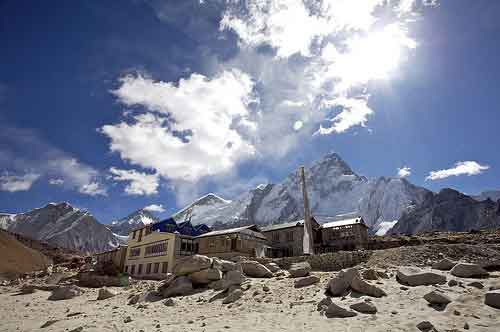
We leave Karanga and hit the junction which connects with the Mweka Trail. We continue up to the rocky section to Barafu Hut. At this point, you have completed the Southern Circuit, which offers views of the summit from many different angles. Here we make camp, rest and enjoy an early dinner to prepare for the summit day. The two peaks of Mawenzi and Kibo are viewable from this position.
8
Day 08: BARAFU CAMP TO UHURU PEAK
| Elevation: 15,331 ft to 19,341 ft | Distance: 5 km / 3 miles |
|---|---|
| Hiking Time: 7-8 hours | Habitat: Arctic |
UHURU PEAK TO MWEKA CAMP
| Elevation: 19,341 ft to 10,065 ft | Distance: 12 km / 7 miles |
|---|---|
| Hiking Time: 4-6 hours | Habitat: Rain forest |
Very early in the morning (around midnight), we begin our push to the summit. This is the most mentally and physically challenging portion of the trek. The wind and cold at this elevation and time of day can be extreme. We ascend in the darkness for several hours while taking frequent, but short, breaks. Near Stella Point (18,900 ft), you will be rewarded with the most magnificent sunrise you are ever likely to see coming over Mawenzi Peak. Finally, we arrive at Uhuru Peak- the highest point on Mount Kilimanjaro and the continent of Africa.
From the summit, we now make our descent continuing straight down to the Mweka Hut camp site, stopping at Barafu for lunch. The trail is very rocky and can be quite hard on the knees; trekking poles are helpful. Mweka Camp is situated in the upper forest and mist or rain can be expected in the late afternoon. Later in the evening, we enjoy our last dinner on the mountain and a well-earned sleep..
09
Day 09: MWEKA CAMP TO MWEKA GATE
| Elevation: 10,065 ft to 5,380 ft | Distance: 10 km / 6.2 miles |
|---|---|
| Hiking Time: 3-4 hours | Habitat: Rain forest |
On our last day, we continue the descent to Mweka Gate and collect the summit certificates. At lower elevations, it can be wet and muddy. From the gate, we continue another hour to Mweka Village. A vehicle will meet us at Mweka Village to drive us back to the hotel in Moshi.
10
Day 10:
On the next day, you will be driven back to the airport for your flight home, leave on one of our safaris, or fly onwards to the island paradise of Zanzibar.
Tour Reviews
There are no reviews yet.
Leave a Review